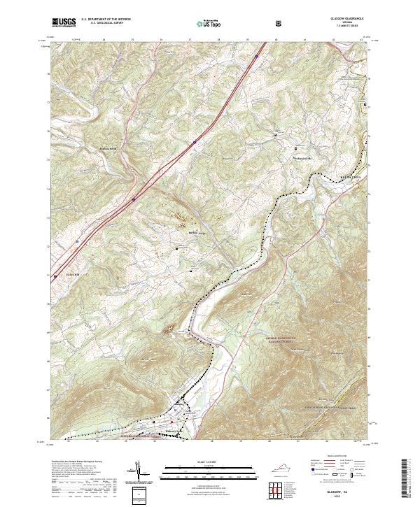
2022 Map of Glasgow
USGS Topo · Published 2022About this map
Glasgow and the surrounding Rockbridge County terrain are defined by the convergence of the James River and the Maury River at Balcony Falls. This 2022 survey illustrates the deep-rooted settlement patterns of the region, where family names are etched into the landscape via landmarks like Salling Family Cem and the historic Buffalo Forge. The topography rises sharply from the riverbanks toward the peaks of Sallings Mtn and Three Sisters Knobs, marking the boundary of the George Washington National Forest.
Find a feature on this map
122 named features on this map. Tap any name to fly to it.
Don’t see what you’re looking for? This feature index may not catch every label — zoom into the map to look around manually.
Map Details
Editions of this 2022 Glasgow Map
This is the sole edition of this map. No revisions or reprints were ever made.
Other maps of this area

1894 · Natural Bridge
USGS Topo · 1:125,000

1894 · Lexington
USGS Topo · 1:125,000

1894 · Natural Bridge
USGS Topo · 1:62,500

1907 · Natural Bridge Special
USGS Topo · 1:62,500

1932 · Lexington
USGS Topo · 1:48,000

1935 · Buena Vista
USGS Topo · 1:48,000

1937 · Lexington
USGS Topo · 1:62,500

1939 · Buena Vista
USGS Topo · 1:62,500

1940 · Buena Vista
USGS Topo · 1:62,500
1946 · Millboro
USGS Topo · 1:62,500