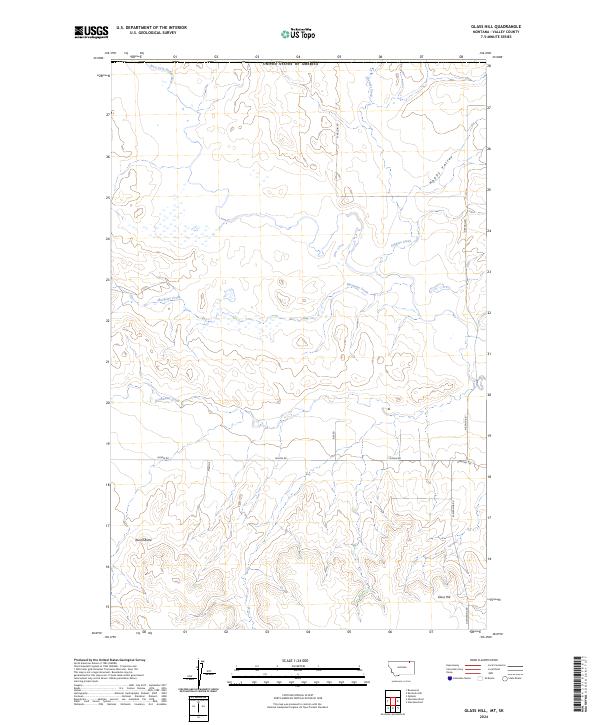
2024 Map of Glass Hill
USGS Topo · Published 2024About this map
West Fork Poplar River carves through this northern Montana landscape, defining the hydrology of a region where wide valleys meet prominent local rises. The terrain is marked by distinct landmarks such as Round Butte and the namesake Glass Hill in the southeast, providing orientation across the open country. The map captures a sparse but structured network of section-line roads and named routes like Mason Rd and Glentanna Rd that serve the agricultural and ranching interests of Valley County. Drainage patterns are influenced by numerous seasonal waterways, including Mosquito Creek, Stewart Creek, and Roanwood Creek, which meander through areas like Happy Valley. This 2024 survey reflects the modern configuration of this high plains environment, showing how the local road network follows the historic Public Land Survey System grids while navigating the natural contours of the river valley.
Find a feature on this map
19 named features on this map. Tap any name to fly to it.
Don’t see what you’re looking for? This feature index may not catch every label — zoom into the map to look around manually.
Map Details
Editions of this 2024 Glass Hill Map
This is the sole edition of this map. No revisions or reprints were ever made.
Other maps of this area

1954 · Glasgow
USGS Topo · 1:250,000

1957 · Glasgow
USGS Topo · 1:250,000

1958 · Glasgow
USGS Topo · 1:250,000

1973 · Glentana West
USGS Topo · 1:24,000

1973 · Opheim
USGS Topo · 1:24,000

1973 · Roanwood
USGS Topo · 1:24,000

1973 · Kaminski Hill
USGS Topo · 1:24,000
1973 · Glentana East
USGS Topo · 1:24,000
1973 · Glass Hill
USGS Topo · 1:24,000

1984 · Opheim
USGS Topo · 1:100,000