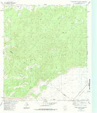
1983 Map of Glass Mountain Ranch
USGS Topo · Published 1984About this map
The Glass Mountains dominate this West Texas landscape, where the high-elevation terrain gives way to the open W B Flats in the southeast. Ranching and resource extraction define the local economy, marked by isolated homesteads like Glass Mountain Ranch and Brooks Ranch. A network of unpaved infrastructure, including a Landing Strip and numerous Jeep Trails, connects these remote outposts across the Pecos and Brewster County line.
Find a feature on this map
16 named features on this map. Tap any name to fly to it.
Don’t see what you’re looking for? This feature index may not catch every label — zoom into the map to look around manually.
Map Details
Editions of this 1983 Glass Mountain Ranch Map
This is the sole edition of this map. No revisions or reprints were ever made.
Other maps of this area

1920 · Longfellow
USGS Topo · 1:125,000

1923 · Hess Canyon
USGS Topo · 1:62,500

1923 · Sierra Madera
USGS Topo · 1:62,500

1928 · Comanche Spring
USGS Topo · 1:125,000

1929 · Hovey
USGS Topo · 1:125,000

1954 · Fort Stockton
USGS Topo · 1:250,000

1958 · Fort Stockton
USGS Topo · 1:250,000

1968 · Marathon Gap
USGS Topo · 1:24,000

1968 · Dimple Hills
USGS Topo · 1:24,000

1973 · Fort Stockton
USGS Topo · 1:250,000