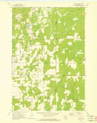
1973 Map of Gleason
USGS Topo · Published 1976About this map
The Prairie River meanders through this portion of eastern Lincoln County, anchoring a landscape defined by its river-and-creek network and rural heritage. The small settlements of Gleason and Dudley serve as local hubs, connected by roads such as Dudley Road and Vascheau Road. This area is notably characterized by its immigrant history, evidenced by the presence of the Estonian Cem and Latvian Cem south of the main village, providing tangible links for genealogists studying the region's Baltic-American settlement patterns.
Find a feature on this map
35 named features on this map. Tap any name to fly to it.
Don’t see what you’re looking for? This feature index may not catch every label — zoom into the map to look around manually.
Map Details
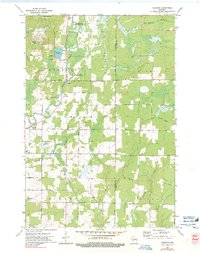
Editions of this 1973 Gleason Map
2 editions found
Other maps of this area

1899 · Wausau
USGS Topo · 1:125,000

1902 · Wausau
USGS Topo · 1:125,000

1940 · Parrish
USGS Topo · 1:48,000

1950 · Parrish
USGS Topo · 1:48,000

1950 · Tomahawk
USGS Topo · 1:48,000

1951 · Doering
USGS Topo · 1:48,000

1951 · Merrill
USGS Topo · 1:48,000

1952 · Parrish
USGS Topo · 1:48,000

1952 · Tomahawk
USGS Topo · 1:48,000

1954 · Iron Mountain
USGS Topo · 1:250,000