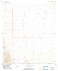
1958 Map of Gleeson SE
USGS Topo · Published 1991About this map
Isolated ranching outposts and infrastructure for water management define this arid landscape in Cochise County during the late 1950s. The presence of 47 Ranch and Dixie Canyon Ranch suggests a region primarily dedicated to cattle operations, supported by a network of essential water sources including Hackberry Windmill, Rattlesnake Tank, and Homestead Tank. The terrain is marked by the significant elevations of the Mule Mountains in the southwest, where deep incisions like Abbot Canyon and Johnson Canyon dominate the topography.
Find a feature on this map
21 named features on this map. Tap any name to fly to it.
Don’t see what you’re looking for? This feature index may not catch every label — zoom into the map to look around manually.
Map Details
Editions of this 1958 Gleeson SE Map
3 editions found
Other maps of this area

1902 · Bisbee
USGS Topo · 1:62,500

1910 · Bisbee
USGS Topo · 1:62,500

1914 · Douglas
USGS Topo · 1:62,500

1916 · Pearce
USGS Topo · 1:125,000

1916 · Douglas
USGS Topo · 1:125,000

1919 · Douglas
USGS Topo · 1:125,000

1922 · Swisshelm
USGS Topo · 1:62,500

1925 · Douglas
USGS Topo · 1:62,500

1925 · Gleeson
USGS Topo · 1:62,500

1927 · Bisbee
USGS Topo · 1:62,500