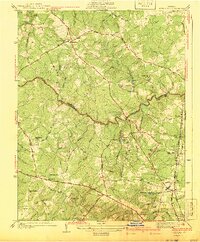
1941 Map of Glen Allen
USGS Topo · Published 1941About this map
Glen Allen and the surrounding rural landscape of Henrico and Hanover Counties are captured here as they appeared in the mid-1930s, shortly after the Washington Highway began modernizing travel through the region. The area is defined by its deep colonial roots, evident in the winding Mountain Road and the convergence of historic routes at Short Pump. This era shows a transition from traditional agricultural life to early suburbanization, where community life centered on landmarks like the Coalpit Sch and St Marks Ch.
Find a feature on this map
60 named features on this map. Tap any name to fly to it.
Don’t see what you’re looking for? This feature index may not catch every label — zoom into the map to look around manually.
Map Details
Editions of this 1941 Glen Allen Map
2 editions found

Other maps of this area

1890 · Goochland
USGS Topo · 1:125,000

1892 · Goochland
USGS Topo · 1:125,000

1894 · Richmond
USGS Topo · 1:62,500

1895 · Richmond
USGS Topo · 1:62,500

1918 · Doswell
USGS Topo · 1:62,500

1934 · Richmond
USGS Topo · 1:24,000

1936 · Richmond West
USGS Topo · 1:24,000

1936 · Glen Allen
USGS Topo · 1:24,000

1938 · Yellow Tavern
USGS Topo · 1:31,680

1939 · Richmond
USGS Topo · 1:31,680