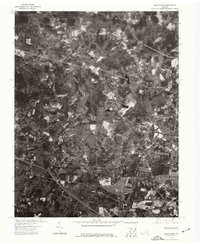
1974 Map of Glen Allen
USGS Topo · Published 1977About this map
Glen Allen and its surrounding Henrico County countryside are captured here in an orthophotoquad format, using aerial photography from 1974. Unlike traditional topographic maps, this imagery reveals the exact footprint of suburban expansion and forest cover during the mid-1970s. The Chickahominy River winds through the landscape, serving as a primary natural boundary and drainage for the region. The map provides a clear look at the early residential subdivisions and the burgeoning road network that defined this part of the Richmond metropolitan area during a period of rapid growth. Researchers can observe the transition from agricultural fields to the planned residential clusters that would come to define the modern community.
Find a feature on this map
2 named features on this map. Tap any name to fly to it.
Don’t see what you’re looking for? This feature index may not catch every label — zoom into the map to look around manually.
Map Details
Editions of this 1974 Glen Allen Map
This is the sole edition of this map. No revisions or reprints were ever made.
Other maps of this area

1890 · Goochland
USGS Topo · 1:125,000

1892 · Goochland
USGS Topo · 1:125,000

1894 · Richmond
USGS Topo · 1:62,500

1895 · Richmond
USGS Topo · 1:62,500

1918 · Doswell
USGS Topo · 1:62,500

1934 · Richmond
USGS Topo · 1:24,000

1936 · Richmond West
USGS Topo · 1:24,000

1936 · Glen Allen
USGS Topo · 1:24,000

1938 · Yellow Tavern
USGS Topo · 1:31,680

1939 · Richmond
USGS Topo · 1:31,680