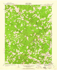
1936 Map of Glen Allen
USGS Topo · Published 1960About this map
The Chickahominy River carves a winding path through the center of this landscape, marking the historic boundary between Hanover and Henrico Counties. In the mid-1930s, this region remained deeply agrarian, defined by a network of rural routes like Mountain Road and Pouncey Tract Road that connected small communities and local parish centers. Spiritual and social life was centered around numerous country churches, including Ground Squirrel Ch, Winns Ch, and Deep Run Ch.
Find a feature on this map
57 named features on this map. Tap any name to fly to it.
Don’t see what you’re looking for? This feature index may not catch every label — zoom into the map to look around manually.
Map Details
Editions of this 1936 Glen Allen Map
2 editions found
Other maps of this area

1890 · Goochland
USGS Topo · 1:125,000

1892 · Goochland
USGS Topo · 1:125,000

1894 · Richmond
USGS Topo · 1:62,500

1895 · Richmond
USGS Topo · 1:62,500

1918 · Doswell
USGS Topo · 1:62,500

1934 · Richmond
USGS Topo · 1:24,000

1936 · Richmond West
USGS Topo · 1:24,000

1936 · Glen Allen
USGS Topo · 1:24,000

1938 · Yellow Tavern
USGS Topo · 1:31,680

1939 · Richmond
USGS Topo · 1:31,680