
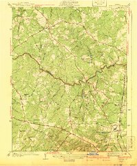
1941 Map of Glen Allen
USGS Topo · Published 1941About this map
The Chickahominy River carves a winding path through this central Virginia landscape, defining the jagged boundary between Hanover and Henrico counties. In the mid-1930s, this region was a network of rural settlements and family-named roads, with Short Pump and Farrington serving as local hubs. The mapping reveals a community deeply rooted in its local institutions, from the Ground Squirrel Ch in the northwest to the Springfield Sch and Coalpit Sch further south.
Find a feature on this map
59 named features on this map. Tap any name to fly to it.
Don’t see what you’re looking for? This feature index may not catch every label — zoom into the map to look around manually.
Map Details
Editions of this 1941 Glen Allen Map
2 editions found
Other maps of this area

1890 · Goochland
USGS Topo · 1:125,000

1892 · Goochland
USGS Topo · 1:125,000

1894 · Richmond
USGS Topo · 1:62,500

1895 · Richmond
USGS Topo · 1:62,500

1918 · Doswell
USGS Topo · 1:62,500

1934 · Richmond
USGS Topo · 1:24,000

1936 · Richmond West
USGS Topo · 1:24,000

1936 · Glen Allen
USGS Topo · 1:24,000

1938 · Yellow Tavern
USGS Topo · 1:31,680

1939 · Richmond
USGS Topo · 1:31,680