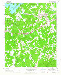
1962 Map of Glen Alpine
USGS Topo · Published 1964About this map
Lake James dominates the northwestern corner of this landscape, its waters contained by the Paddy Creek Dam and the Linville Dam Powerhouse. The terrain is defined by the steep valleys of the Catawba River and Silver Creek, where small agrarian settlements and dozens of country churches anchor the community. The Southern railroad line cuts through the north, serving Glen Alpine and Bridgewater, while the newly constructed highway corridor follows the path of Jamestown Road across the central hills. This 1960s study reveals a region where traditional land use meets modern infrastructure, evidenced by landmarks like the Mt Alpine Sch and the State Hospital Reservoir. Genealogy researchers will find numerous family-named sites, from the Mc Dowell Ch to England Knob, alongside historic land tracts like Quaker Meadow.
Find a feature on this map
66 named features on this map. Tap any name to fly to it.
Don’t see what you’re looking for? This feature index may not catch every label — zoom into the map to look around manually.
Map Details
Editions of this 1962 Glen Alpine Map
This is the sole edition of this map. No revisions or reprints were ever made.
Other maps of this area

1905 · Morganton
USGS Topo · 1:125,000

1953 · Charlotte
USGS Topo · 1:250,000

1954 · Charlotte
USGS Topo · 1:250,000

1956 · Oak Hill
USGS Topo · 1:24,000

1956 · Benn Knob
USGS Topo · 1:24,000

1956 · Morganton North
USGS Topo · 1:24,000

1956 · Ashford
USGS Topo · 1:24,000

1956 · Morganton South
USGS Topo · 1:24,000

1956 · Linville Falls
USGS Topo · 1:62,500

1956 · Lenoir
USGS Topo · 1:62,500