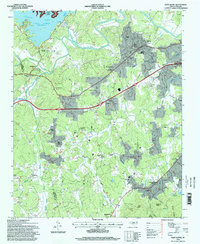
1994 Map of Glen Alpine
USGS Topo · Published 1998About this map
The Catawba River and its impoundment at Lake James dominate this corner of Burke County, where the foothills of the Pisgah National Forest meet the industrial and agricultural corridors of the Catawba Valley. The town of Glen Alpine serves as the primary hub, situated along the Southern railroad line and a network of secondary roads like Jamestown Road. The landscape is a mix of small settlements and family-named landmarks, such as the Linville Dam Powerhouse and the State Hospital Reservoir, which highlight the importance of water management and institutional infrastructure in the region during the late twentieth century.
Find a feature on this map
64 named features on this map. Tap any name to fly to it.
Don’t see what you’re looking for? This feature index may not catch every label — zoom into the map to look around manually.
Map Details
Editions of this 1994 Glen Alpine Map
This is the sole edition of this map. No revisions or reprints were ever made.
Other maps of this area

1905 · Morganton
USGS Topo · 1:125,000

1953 · Charlotte
USGS Topo · 1:250,000

1954 · Charlotte
USGS Topo · 1:250,000

1956 · Oak Hill
USGS Topo · 1:24,000

1956 · Benn Knob
USGS Topo · 1:24,000

1956 · Morganton North
USGS Topo · 1:24,000

1956 · Ashford
USGS Topo · 1:24,000

1956 · Morganton South
USGS Topo · 1:24,000

1956 · Linville Falls
USGS Topo · 1:62,500

1956 · Lenoir
USGS Topo · 1:62,500