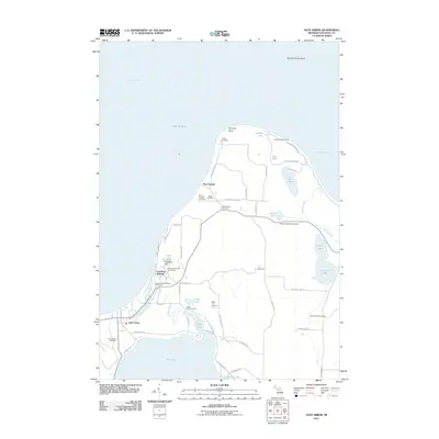
2011 Map of Glen Arbor
USGS Topo · Published 2011About this map
Port Oneida and Glen Arbor anchor this coastal landscape along the Manitou Passage in the early 21st century. The map reveals a high concentration of small family and community burial grounds, including the Werner-Erickson Cemetery, Miller Cemetery, and Kelderhouse Cemetery, which point to the deep-rooted settlement history of the Leelanau Peninsula. Educational and recreational institutions are prominent, with the Leelanau Schools and North University School situated near the shorelines.
Find a feature on this map
61 named features on this map. Tap any name to fly to it.
Don’t see what you’re looking for? This feature index may not catch every label — zoom into the map to look around manually.
Map Details
Editions of this 2011 Glen Arbor Map
This is the sole edition of this map. No revisions or reprints were ever made.
Other maps of this area

1954 · Traverse City
USGS Topo · 1:250,000

1954 · Escanaba
USGS Topo · 1:250,000

1954 · Manitowoc
USGS Topo · 1:250,000

1955 · Cheboygan
USGS Topo · 1:250,000

1956 · North Manitou
USGS Topo · 1:62,500

1957 · Escanaba
USGS Topo · 1:250,000

1957 · Empire
USGS Topo · 1:62,500

1957 · Maple City
USGS Topo · 1:62,500

1958 · Escanaba
USGS Topo · 1:250,000

1958 · Cheboygan
USGS Topo · 1:250,000