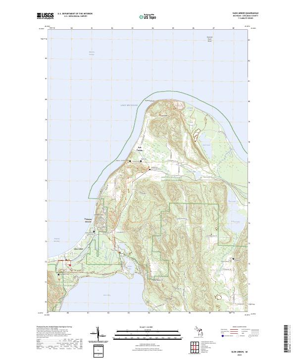
2023 Map of Glen Arbor
USGS Topo · Published 2023About this map
Sleeping Bear Dunes National Lakeshore dominates this coastal landscape along the Lake Michigan shoreline. This modern survey illustrates the conservation of the area, where natural features like Pyramid Point and Prospect Hill overlook the waters of Sleeping Bear Bay and the Manitou Passage. The mapping of small inland bodies such as Shell Lake, School Lake, and Fisher Lake shows a complex glacial geography where water and sand dunes define the terrain.
Find a feature on this map
83 named features on this map. Tap any name to fly to it.
Don’t see what you’re looking for? This feature index may not catch every label — zoom into the map to look around manually.
Map Details
Editions of this 2023 Glen Arbor Map
This is the sole edition of this map. No revisions or reprints were ever made.
Other maps of this area

1954 · Traverse City
USGS Topo · 1:250,000

1954 · Escanaba
USGS Topo · 1:250,000

1954 · Manitowoc
USGS Topo · 1:250,000

1955 · Cheboygan
USGS Topo · 1:250,000

1956 · North Manitou
USGS Topo · 1:62,500

1957 · Escanaba
USGS Topo · 1:250,000

1957 · Empire
USGS Topo · 1:62,500

1957 · Maple City
USGS Topo · 1:62,500

1958 · Escanaba
USGS Topo · 1:250,000

1958 · Cheboygan
USGS Topo · 1:250,000