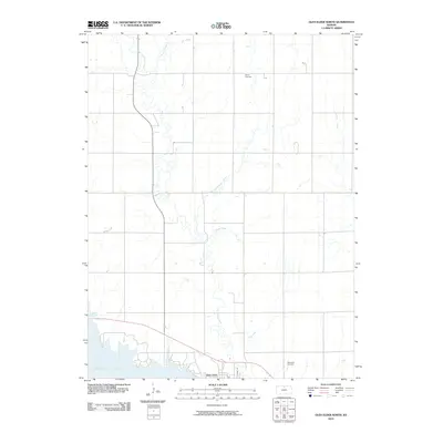
2010 Map of Glen Elder North
USGS Topo · Published 2010About this map
Glen Elder sits on the northern edge of the massive Waconda Lake reservoir, serving as the primary anchor for this rural landscape in Mitchell County. The map details a complex network of waterways that feed into the lake, including Limestone Creek, Frog Creek, and the uniquely named Disappointment Creek. These streams carve through a predominantly agricultural grid, where the placement of the Athens Cemetery and Glenwood Cemetery provides valuable landmarks for local genealogy and land-use history. The terrain is defined by the intersection of small-town infrastructure, such as Nash St, and the expansive shoreline of the reservoir, illustrating how the 20th-century creation of the lake fundamentally altered the local drainage patterns of Ash Creek and Spring Branch.
Find a feature on this map
11 named features on this map. Tap any name to fly to it.
Don’t see what you’re looking for? This feature index may not catch every label — zoom into the map to look around manually.
Map Details
Editions of this 2010 Glen Elder North Map
This is the sole edition of this map. No revisions or reprints were ever made.
Other maps of this area

1894 · Mankato
USGS Topo · 1:125,000

1894 · Beloit
USGS Topo · 1:125,000

1953 · Solomon Rapids
USGS Topo · 1:24,000

1953 · Waconda Springs
USGS Topo · 1:24,000

1953 · Glen Elder South
USGS Topo · 1:24,000

1955 · Beloit
USGS Topo · 1:250,000

1959 · Beloit
USGS Topo · 1:250,000

1962 · Cawker City
USGS Topo · 1:24,000

1962 · Glen Elder North
USGS Topo · 1:24,000

1962 · Jewell SW
USGS Topo · 1:24,000