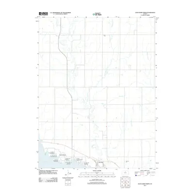
2012 Map of Glen Elder North
USGS Topo · Published 2012About this map
Waconda Lake dominates the southern landscape of this Mitchell County region, where the reservoir shoreline is lined with numerous recreational facilities such as the Glen Elder State Park Kiowa Campground and Glen Elder State Park Osage Campground. The town of Glen Elder sits just east of the dam, serving as a gateway to the water and the surrounding agricultural lands. This topography is defined by the convergence of several waterways, including Limestone Cr, Disappointment Cr, and Ash Cr, which carve through the plains toward the Solomon River valley. Family historians can find two significant burial sites in the rural sections of the map: Athens Cem to the north and Glenwood Cem located southeast of the main settlement. The grid of country roads, anchored by Route 24 and Route 128, illustrates the intersection of recreation and traditional prairie ranching.
Find a feature on this map
23 named features on this map. Tap any name to fly to it.
Don’t see what you’re looking for? This feature index may not catch every label — zoom into the map to look around manually.
Map Details
Editions of this 2012 Glen Elder North Map
This is the sole edition of this map. No revisions or reprints were ever made.
Other maps of this area

1894 · Mankato
USGS Topo · 1:125,000

1894 · Beloit
USGS Topo · 1:125,000

1953 · Solomon Rapids
USGS Topo · 1:24,000

1953 · Waconda Springs
USGS Topo · 1:24,000

1953 · Glen Elder South
USGS Topo · 1:24,000

1955 · Beloit
USGS Topo · 1:250,000

1959 · Beloit
USGS Topo · 1:250,000

1962 · Cawker City
USGS Topo · 1:24,000

1962 · Glen Elder North
USGS Topo · 1:24,000

1962 · Jewell SW
USGS Topo · 1:24,000