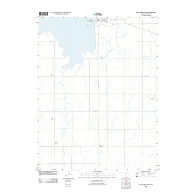
2012 Map of Glen Elder South
USGS Topo · Published 2012About this map
Waconda Lake dominates the northern landscape of this Mitchell County region, where the Solomon River flows eastward from the Glen Elder dam. The town of Glen Elder sits just north of the river, organized along a traditional grid including E Main St and Railroad St. This 2012 survey illustrates a landscape deeply connected to its rural roots and genealogy, evidenced by the numerous cemeteries scattered across the plains, such as Fairview Cem and High Prairie Cem. The drainage patterns of Little Walnut Cr and Walnut Cr define the southern terrain, where local travel is managed by routes like Tipton Rd and W Main St Rd. For those interested in the recreational development of the area, the Glen Elder State Park Pawnee Campground is clearly marked along the lakeshore.
Find a feature on this map
24 named features on this map. Tap any name to fly to it.
Don’t see what you’re looking for? This feature index may not catch every label — zoom into the map to look around manually.
Map Details
Editions of this 2012 Glen Elder South Map
This is the sole edition of this map. No revisions or reprints were ever made.
Other maps of this area

1894 · Mankato
USGS Topo · 1:125,000

1894 · Beloit
USGS Topo · 1:125,000

1953 · Solomon Rapids
USGS Topo · 1:24,000

1953 · Waconda Springs
USGS Topo · 1:24,000

1953 · Glen Elder South
USGS Topo · 1:24,000

1955 · Beloit
USGS Topo · 1:250,000

1959 · Beloit
USGS Topo · 1:250,000

1962 · Cawker City
USGS Topo · 1:24,000

1962 · Glen Elder North
USGS Topo · 1:24,000

1962 · Jewell SW
USGS Topo · 1:24,000