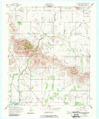
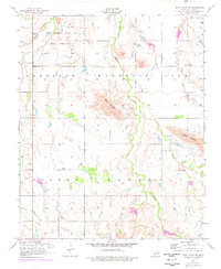
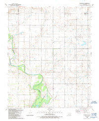
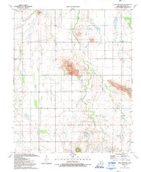
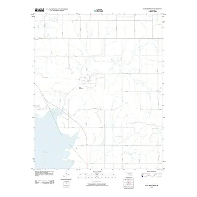
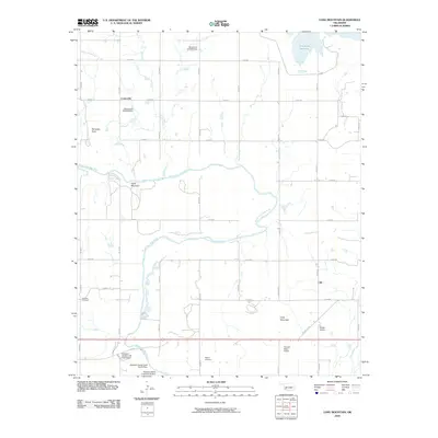
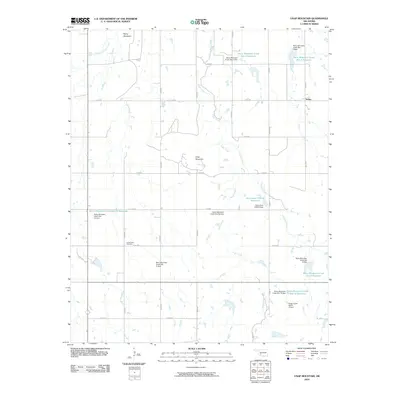
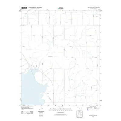
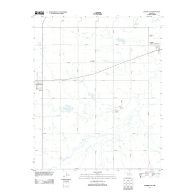
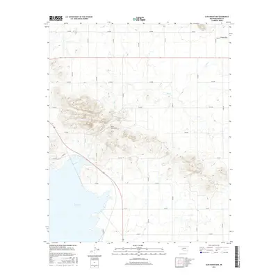
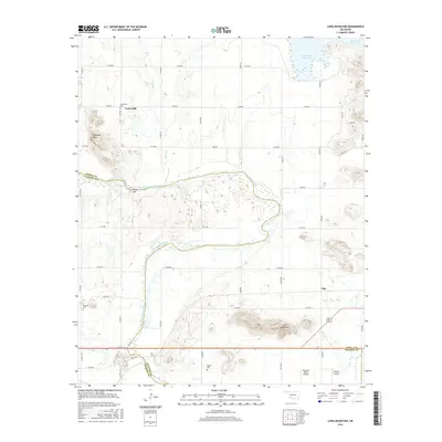
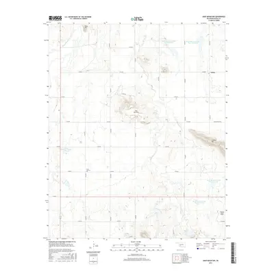
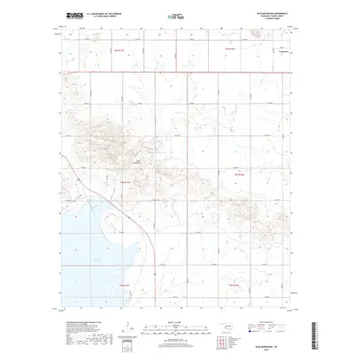
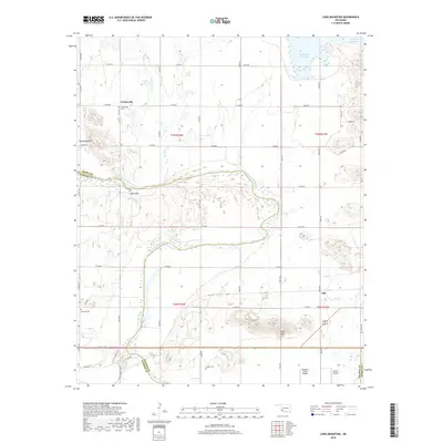
1956 Map of Glen Mountains
USGS Topo · Published 1986About this map
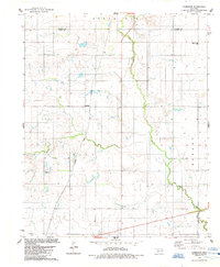
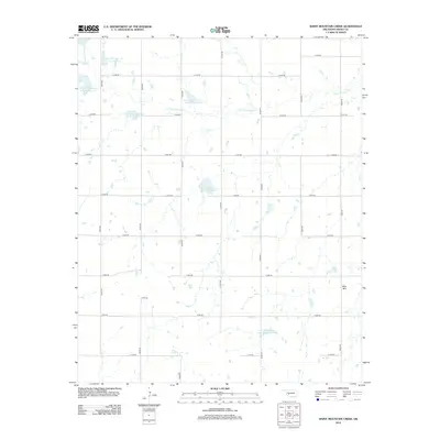
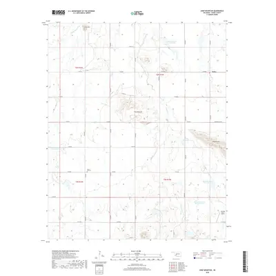
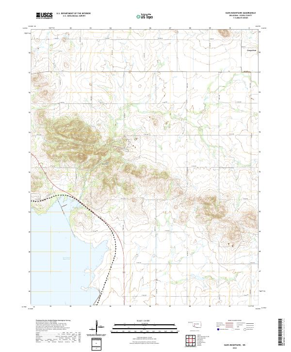
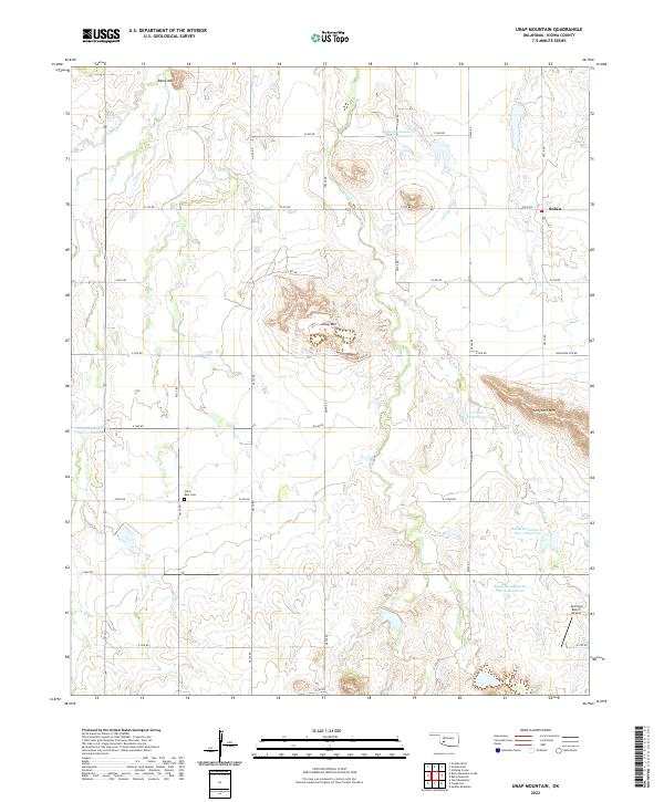
The Glen Mountains dominate the central landscape of this Oklahoma quadrangle, where the rugged topography gives way to the lower elevations around Cooperton to the northeast. Settlement in this portion of Kiowa County during the mid-1950s was characterized by sparse clusters of ranching or agricultural activity, with the St Louis San Francisco railroad cutting a diagonal line across the southwest corner. The landscape is marked by the presence of a Gold Mine (Abandoned) south of the primary peaks, reflecting early dreams of mineral wealth in the Wichita Mountains region. Hydrological features like Glen Creek, West Otter Creek, and Snyder Lake define the drainage patterns, while specialized recreational landmarks like the Swimming Pool near the northern boundary point to the social life of the local community. Large tracts of land, including Otter Creek and Mountain Park, indicate the division of this rocky terrain into managed areas.
Find a feature on this map
12 named features on this map. Tap any name to fly to it.
Don’t see what you’re looking for? This feature index may not catch every label — zoom into the map to look around manually.
Map Details
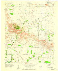
Editions of this 1956 Glen Mountains Map
2 editions found
Historical Maps of Cooperton Through Time
76 maps found
1956 Bally Mountain
Kiowa County, OK
1956 Glen Mountains
Kiowa County, OK
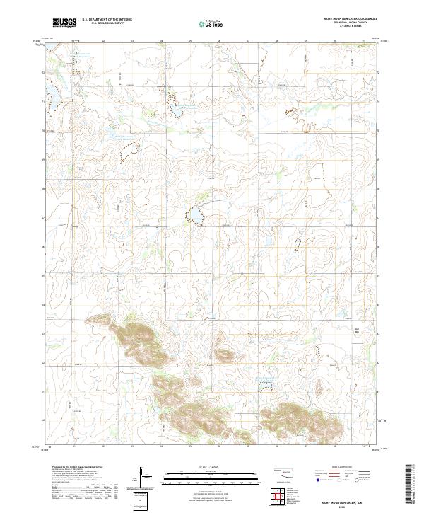
1956 Rainy Mountain Creek
Kiowa County, OK
1956 Unap Mountain
Kiowa County, OK
1963 Babbs
Kiowa County, OK
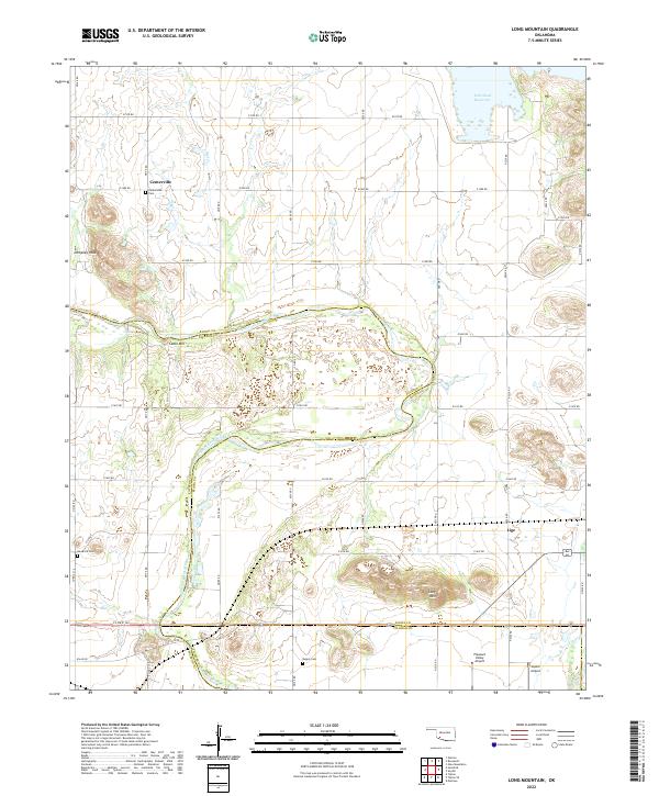
1964 Long Mountain
Kiowa County, OK
1971 Lake Altus
Kiowa County, OK
1984 Cambridge
Kiowa County, OK
1984 Gotebo East
Kiowa County, OK
1984 Gotebo West
Kiowa County, OK
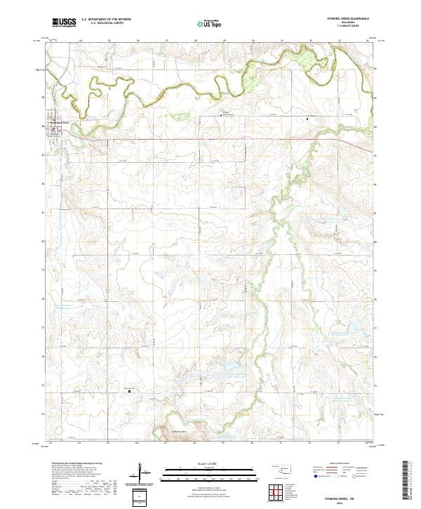
1984 Stinking Creek
Kiowa County, OK
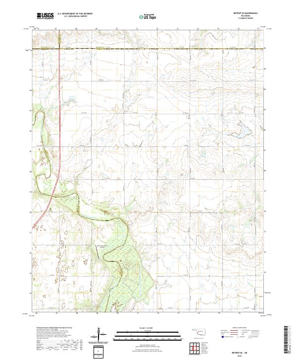
1989 Retrop SE
Kiowa County, OK
1991 Bally Mountain
Kiowa County, OK
1991 Glen Mountains
Kiowa County, OK
1991 Rainy Mountain Creek
Kiowa County, OK
1991 Unap Mountain
Kiowa County, OK
2010 Babbs
Kiowa County, OK
2010 Bally Mountain
Kiowa County, OK
2010 Cambridge
Kiowa County, OK
2010 Glen Mountains
Kiowa County, OK
2010 Gotebo East
Kiowa County, OK
2010 Gotebo West
Kiowa County, OK
2010 Lake Altus
Kiowa County, OK
2010 Long Mountain
Kiowa County, OK
2010 Rainy Mountain Creek
Kiowa County, OK
2010 Retrop SE
Kiowa County, OK
2010 Stinking Creek
Kiowa County, OK
2010 Unap Mountain
Kiowa County, OK
2012 Babbs
Kiowa County, OK
2012 Bally Mountain
Kiowa County, OK
2012 Cambridge
Kiowa County, OK
2012 Glen Mountains
Kiowa County, OK
2012 Gotebo West
Kiowa County, OK
2012 Lake Altus
Kiowa County, OK
2012 Long Mountain
Kiowa County, OK
2012 Rainy Mountain Creek
Kiowa County, OK
2012 Retrop SE
Kiowa County, OK
2012 Stinking Creek
Kiowa County, OK
2012 Unap Mountain
Kiowa County, OK
2013 Gotebo East
Kiowa County, OK
2016 Babbs
Kiowa County, OK
2016 Bally Mountain
Kiowa County, OK
2016 Cambridge
Kiowa County, OK
2016 Glen Mountains
Kiowa County, OK
2016 Gotebo East
Kiowa County, OK
2016 Gotebo West
Kiowa County, OK
2016 Lake Altus
Kiowa County, OK
2016 Long Mountain
Kiowa County, OK
2016 Rainy Mountain Creek
Kiowa County, OK
2016 Retrop SE
Kiowa County, OK
2016 Stinking Creek
Kiowa County, OK
2016 Unap Mountain
Kiowa County, OK
2018 Babbs
Kiowa County, OK
2018 Bally Mountain
Kiowa County, OK
2018 Cambridge
Kiowa County, OK
2018 Glen Mountains
Kiowa County, OK
2018 Gotebo East
Kiowa County, OK
2018 Gotebo West
Kiowa County, OK
2018 Lake Altus
Kiowa County, OK
2018 Long Mountain
Kiowa County, OK
2018 Rainy Mountain Creek
Kiowa County, OK
2018 Retrop SE
Kiowa County, OK
2018 Stinking Creek
Kiowa County, OK
2018 Unap Mountain
Kiowa County, OK
2022 Babbs
Kiowa County, OK
2022 Bally Mountain
Kiowa County, OK
2022 Cambridge
Kiowa County, OK
2022 Glen Mountains
Kiowa County, OK
2022 Gotebo East
Kiowa County, OK
2022 Gotebo West
Kiowa County, OK
2022 Lake Altus
Kiowa County, OK
2022 Long Mountain
Kiowa County, OK
2022 Rainy Mountain Creek
Kiowa County, OK
2022 Retrop SE
Kiowa County, OK
2022 Stinking Creek
Kiowa County, OK
2022 Unap Mountain
Kiowa County, OK