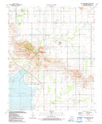
1991 Map of Glen Mountains
USGS Topo · Published 1992About this map
Tom Steed Reservoir dominates the southwestern portion of this landscape, its shoreline defining the borders of Great Plains State Park. The terrain is characterized by the prominent rises of the Glen Mountains, which stretch across the central and southeastern sections of the quadrangle. Resource extraction is evident through several scattered labels for Gravel Pits and a Quarry, including a specific Mine (Abandoned) located near the park boundary. A Levee and various wells suggest local water management efforts beyond the reservoir's reach. This 1991 edition, edited from aerial photography, provides a clear view of the recreational and industrial infrastructure of the era, from the Boat Ramp on the water to the Radio Tower on higher ground, while Glen Creek meanders through the northern plains.
Find a feature on this map
14 named features on this map. Tap any name to fly to it.
Don’t see what you’re looking for? This feature index may not catch every label — zoom into the map to look around manually.
Map Details
Editions of this 1991 Glen Mountains Map
This is the sole edition of this map. No revisions or reprints were ever made.
Other maps of this area

1949 · Cooperton
USGS Topo · 1:62,500

1950 · Snyder
USGS Topo · 1:62,500

1955 · Lawton
USGS Topo · 1:250,000

1956 · Glen Mountains
USGS Topo · 1:24,000

1956 · Cooperton
USGS Topo · 1:24,000

1956 · Odetta
USGS Topo · 1:24,000

1956 · Unap Mountain
USGS Topo · 1:24,000

1956 · Snyder
USGS Topo · 1:24,000

1956 · Rainy Mountain Creek
USGS Topo · 1:24,000

1956 · Snyder
USGS Topo · 1:62,500