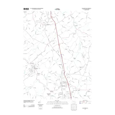
2013 Map of Glen Rock
USGS Topo · Published 2013About this map
Shrewsbury and the borough of Glen Rock anchor this southern York County landscape, where the Interstate 83 corridor bisects a region of deeply rooted agricultural and industrial heritage. The map documents a cluster of settlements that grew around early transit lines, including the village of Railroad and the tracks of the Stewartstown RR. The terrain is defined by the winding paths of the South Br Codorus Cr and Fishel Cr, which carve through valleys such as Dunkard Valley and Rehmeyer Hollow. Small centers like Loganville, Hametown, and Seitzland remain distinct hubs amidst the rolling acreage of Neitzel Farms and Wilson Farms. This survey also captures modern land use, from the Shoestring Aviation Airfield to the Bon Air Golf Course, illustrating the transition of these traditional rural spaces into contemporary residential and recreational communities while preserving their historical place-names.
Find a feature on this map
263 named features on this map. Tap any name to fly to it.
Don’t see what you’re looking for? This feature index may not catch every label — zoom into the map to look around manually.
Map Details
Editions of this 2013 Glen Rock Map
This is the sole edition of this map. No revisions or reprints were ever made.
Other maps of this area

1900 · Parkton
USGS Topo · 1:62,500

1902 · Parkton
USGS Topo · 1:62,500

1905 · Westminster
USGS Topo · 1:62,500

1908 · York
USGS Topo · 1:62,500

1910 · York
USGS Topo · 1:62,500

1920 · Hanover
USGS Topo · 1:62,500

1922 · Hanover
USGS Topo · 1:62,500

1944 · New Freedom
USGS Topo · 1:31,680

1944 · Norrisville
USGS Topo · 1:31,680

1944 · Lineboro
USGS Topo · 1:31,680