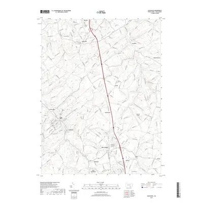
2019 Map of Glen Rock
USGS Topo · Published 2019About this map
Glen Rock Valley and Dunkard Valley carve the landscape of southern York County, defining a network of small settlements connected by the winding waters of the S Br Codorus Cr and E Br Codorus Cr. This 2019 survey captures the developed corridor stretching from Jacobus and Loganville in the north down through Shrewsbury and New Freedom near the Maryland border. The map reveals a high density of local history markers, including the Reformed Church and numerous family or community burial grounds like Chestnut Hill Cem and Seitz Cem. This document is particularly useful for tracing modern land use alongside historical settlement patterns, showing how newer developments interface with traditional landmarks such as the Shoestring Aviation Airfield and the smaller hamlets of Seitzland and Hametown.
Find a feature on this map
193 named features on this map. Tap any name to fly to it.
Don’t see what you’re looking for? This feature index may not catch every label — zoom into the map to look around manually.
Map Details
Editions of this 2019 Glen Rock Map
This is the sole edition of this map. No revisions or reprints were ever made.
Other maps of this area

1900 · Parkton
USGS Topo · 1:62,500

1902 · Parkton
USGS Topo · 1:62,500

1905 · Westminster
USGS Topo · 1:62,500

1908 · York
USGS Topo · 1:62,500

1910 · York
USGS Topo · 1:62,500

1920 · Hanover
USGS Topo · 1:62,500

1922 · Hanover
USGS Topo · 1:62,500

1944 · New Freedom
USGS Topo · 1:31,680

1944 · Norrisville
USGS Topo · 1:31,680

1944 · Lineboro
USGS Topo · 1:31,680