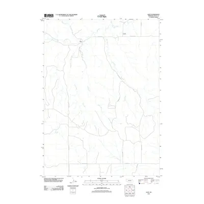
2011 Map of Glen
USGS Topo · Published 2011About this map
The small settlement of Glen serves as the focal point of this Sioux County landscape, situated where Glen RD meets the path of the White River. The terrain is defined by a dense network of drainage systems, with Bull Creek and Spring Creek carving southward through the high plains. This map captures the rural infrastructure of the early 21st century, where long-established routes like Corkscrew Rd and W Belmont Rd provide access to remote agricultural holdings. A sense of the area's social history is preserved in names like Glendale Cemetery and the descriptive Pink School House RD, indicating former community landmarks that anchored this ranching country. The intricate contour lines illustrate the complex transition from the river valley to the elevated divides that separate Deep Creek from its neighboring watercourses.
Find a feature on this map
18 named features on this map. Tap any name to fly to it.
Don’t see what you’re looking for? This feature index may not catch every label — zoom into the map to look around manually.
Map Details
Editions of this 2011 Glen Map
This is the sole edition of this map. No revisions or reprints were ever made.
Other maps of this area

1899 · Whistle Creek
USGS Topo · 1:125,000

1951 · Marsland
USGS Topo · 1:62,500

1955 · Alliance
USGS Topo · 1:250,000

1957 · Alliance
USGS Topo · 1:250,000

1958 · Alliance
USGS Topo · 1:250,000

1980 · Kyle Creek
USGS Topo · 1:24,000

1980 · Smiley Canyon
USGS Topo · 1:24,000

1980 · Andrews
USGS Topo · 1:24,000

1980 · Dead Mans Creek
USGS Topo · 1:24,000
1980 · Crawford
USGS Topo · 1:24,000