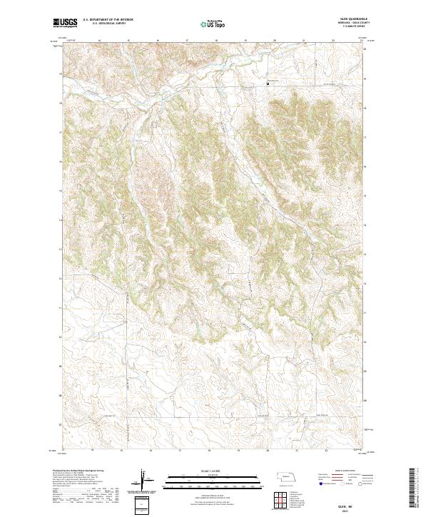
2021 Map of Glen
USGS Topo · Published 2021About this map
White River valley drainage and a network of rural section roads define this portion of Sioux County. The landscape is carved by numerous seasonal waterways including Deep Cr, Charcoal Cr, and Bull Cr, which navigate the broken terrain between high ridge lines. Settlement patterns are sparse, tied to the winding paths of Corkscrew Rd and Glen Rd. Local history is anchored by the Glendale Cem in the north and the evocatively named Pink School House Rd to the south. This area demonstrates a persistent dependence on traditional land divisions and remote access routes like Vantine Rd and Cobblehill RD, where the topography dictates the flow of travel far more than modern infrastructure.
Find a feature on this map
23 named features on this map. Tap any name to fly to it.
Don’t see what you’re looking for? This feature index may not catch every label — zoom into the map to look around manually.
Map Details
Editions of this 2021 Glen Map
This is the sole edition of this map. No revisions or reprints were ever made.
Other maps of this area

1899 · Whistle Creek
USGS Topo · 1:125,000

1951 · Marsland
USGS Topo · 1:62,500

1955 · Alliance
USGS Topo · 1:250,000

1957 · Alliance
USGS Topo · 1:250,000

1958 · Alliance
USGS Topo · 1:250,000

1980 · Kyle Creek
USGS Topo · 1:24,000

1980 · Smiley Canyon
USGS Topo · 1:24,000

1980 · Andrews
USGS Topo · 1:24,000

1980 · Dead Mans Creek
USGS Topo · 1:24,000
1980 · Crawford
USGS Topo · 1:24,000