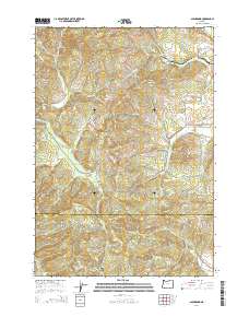
2014 Map of Glenbrook
USGS Topo · Published 2014About this map
Green Peak and the surrounding high ground of the Oregon Coast Range define this 2014 survey on the border of Benton and Lane Counties. The landscape is marked by a complex network of timber and access roads, including numerous Bureau of Land Management (BLM) routes such as BLM S Fork Rd and BLM 15-7-12. In the valleys, the small settlement of Glenbrook sits near the confluence of Weaver Cr and Nye Cr, while the S Fork Alsea River carves its way through the western portion of the quadrangle.
Find a feature on this map
68 named features on this map. Tap any name to fly to it.
Don’t see what you’re looking for? This feature index may not catch every label — zoom into the map to look around manually.
Map Details
Editions of this 2014 Glenbrook Map
This is the sole edition of this map. No revisions or reprints were ever made.
Other maps of this area

1909 · Elmira
USGS Topo · 1:62,500

1911 · Monroe
USGS Topo · 1:31,680

1911 · Inavale
USGS Topo · 1:31,680

1922 · Monroe
USGS Topo · 1:62,500

1922 · Elmira
USGS Topo · 1:62,500

1939 · Monroe
USGS Topo · 1:62,500

1941 · Blachly
USGS Topo · 1:62,500

1942 · Alsea
USGS Topo · 1:62,500

1942 · Elmira
USGS Topo · 1:62,500

1942 · Blachly
USGS Topo · 1:62,500