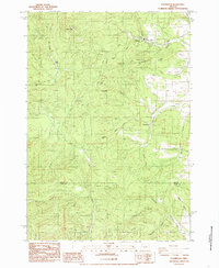
1984 Map of Glenbrook
USGS Topo · Published 1985About this map
Dawson and Glenbrook anchor this landscape along the foothills of the Coast Range, where the timber economy is etched into the terrain. The map reveals a complex network of logging infrastructure, highlighted by the Hull Oakes Road and an Old RR Grade that traces the path of earlier industrial transport. Water dominates the geography, with the South Fork Alsea River carving through the center of the sheet, punctuated by Alsea Falls and Green Peak Falls.
Find a feature on this map
40 named features on this map. Tap any name to fly to it.
Don’t see what you’re looking for? This feature index may not catch every label — zoom into the map to look around manually.
Map Details
Editions of this 1984 Glenbrook Map
This is the sole edition of this map. No revisions or reprints were ever made.
Other maps of this area

1909 · Elmira
USGS Topo · 1:62,500

1911 · Monroe
USGS Topo · 1:31,680

1911 · Inavale
USGS Topo · 1:31,680

1922 · Monroe
USGS Topo · 1:62,500

1922 · Elmira
USGS Topo · 1:62,500

1939 · Monroe
USGS Topo · 1:62,500

1941 · Blachly
USGS Topo · 1:62,500

1942 · Alsea
USGS Topo · 1:62,500

1942 · Elmira
USGS Topo · 1:62,500

1942 · Blachly
USGS Topo · 1:62,500