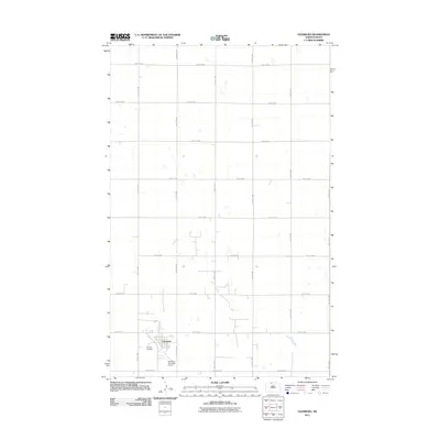
2011 Map of Glenburn
USGS Topo · Published 2011About this map
The town of Glenburn anchors the southwestern corner of this North Dakota landscape, showing the organized grid of a small prairie community in the early 21st century. The map provides a detailed view of the local infrastructure, including the Glenburn Municipal Airport and the Fairview Cemetery situated just west of the main residential area. Beyond the town limits, the terrain is defined by a rigorous township-and-range section line road system, with thoroughfares such as Glenburn Rd and 83rd St NW spanning the wide agricultural expanses. Small, scattered depressions and water features break the geometric regularity of the section lines, reflecting the glaciated prairie pothole topography common to this region. This survey serves as a precise record of rural Renville County, documenting the specific locations of homesteads and municipal facilities that support the surrounding farming economy.
Find a feature on this map
18 named features on this map. Tap any name to fly to it.
Don’t see what you’re looking for? This feature index may not catch every label — zoom into the map to look around manually.
Map Details
Editions of this 2011 Glenburn Map
This is the sole edition of this map. No revisions or reprints were ever made.
Other maps of this area

1948 · Lansford
USGS Topo · 1:62,500

1948 · Burlington
USGS Topo · 1:62,500

1949 · Glenburn
USGS Topo · 1:24,000

1949 · Deering NW
USGS Topo · 1:24,000

1949 · Lansford SE
USGS Topo · 1:24,000

1949 · Lansford NE
USGS Topo · 1:24,000

1949 · Maxbass
USGS Topo · 1:24,000

1949 · Eckman SE
USGS Topo · 1:24,000

1949 · Eckman
USGS Topo · 1:24,000

1949 · Deering
USGS Topo · 1:24,000