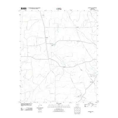
2011 Map of Glendale
USGS Topo · Published 2011About this map
Glendale and the surrounding rural landscape of Lincoln County are defined by a network of creeks and small family cemeteries that trace the region's agricultural history. The drainage patterns of Sanders Creek, Browning Creek, and Clear Creek shape the placement of small settlements like Palmyra and Feenyville, while larger water features such as Patocca Upper Lake and Capps Lake highlight the importance of water management in this part of Arkansas. Local genealogists will find significant value in the distribution of family and community burial grounds, including Zachary Cemetery in the north and Jones Cemetery near Branchville in the southeast. The road network, featuring routes like Old Military Rd, reflects long-standing corridors of travel through these rural townships. These features collectively illustrate the enduring character of this settled landscape in the early 21st century.
Find a feature on this map
46 named features on this map. Tap any name to fly to it.
Don’t see what you’re looking for? This feature index may not catch every label — zoom into the map to look around manually.
Map Details
Editions of this 2011 Glendale Map
This is the sole edition of this map. No revisions or reprints were ever made.
Other maps of this area

1935 · Feenyville
USGS Topo · 1:62,500

1935 · Noble Lake
USGS Topo · 1:62,500

1948 · Helena
USGS Topo · 1:250,000

1950 · Helena
USGS Topo · 1:250,000

1953 · Greenwood
USGS Topo · 1:250,000

1953 · El Dorado
USGS Topo · 1:250,000

1955 · Helena
USGS Topo · 1:250,000

1955 · Little Rock
USGS Topo · 1:250,000

1956 · Little Rock
USGS Topo · 1:250,000

1956 · Greenwood
USGS Topo · 1:250,000