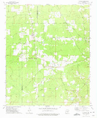
1973 Map of Glendale
USGS Topo · Published 1975About this map
Cleveland and Lincoln County lines intersect this rural landscape in the early 1970s, anchoring a network of small agricultural settlements and family-named cemeteries. The crossroads at Glendale and the cluster at Palmyra serve as local hubs, connected by historic thoroughfares like Military Road and Feenyville Road. This area is heavily defined by its drainage basins, with Turtle Creek and Hickory Grove Creek carving through the terrain, alongside numerous Gravel Pits that suggest local extractive industry.
Find a feature on this map
29 named features on this map. Tap any name to fly to it.
Don’t see what you’re looking for? This feature index may not catch every label — zoom into the map to look around manually.
Map Details
Editions of this 1973 Glendale Map
This is the sole edition of this map. No revisions or reprints were ever made.
Other maps of this area

1935 · Feenyville
USGS Topo · 1:62,500

1935 · Noble Lake
USGS Topo · 1:62,500

1948 · Helena
USGS Topo · 1:250,000

1950 · Helena
USGS Topo · 1:250,000

1953 · Greenwood
USGS Topo · 1:250,000

1953 · El Dorado
USGS Topo · 1:250,000

1955 · Helena
USGS Topo · 1:250,000

1955 · Little Rock
USGS Topo · 1:250,000

1956 · Little Rock
USGS Topo · 1:250,000

1956 · Greenwood
USGS Topo · 1:250,000