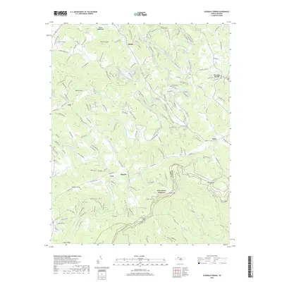
2019 Map of Glendale Springs
USGS Topo · Published 2019About this map
Blue Ridge Parkway winds through this section of the High Country, following the crest of the Eastern Continental Divide near the border of Ashe and Wilkes counties. The landscape is defined by the high elevations of Henson Mountain and Benge Knob, where the South Fork New River and its various tributaries, such as Beaver Creek and West Fork Pine Swamp Creek, begin their descent. Small mountain communities including Glendale Springs, Idlewild, and Obids are scattered across the terrain, connected by a network of winding ridge-top and valley roads.
Find a feature on this map
39 named features on this map. Tap any name to fly to it.
Don’t see what you’re looking for? This feature index may not catch every label — zoom into the map to look around manually.
Map Details
Editions of this 2019 Glendale Springs Map
This is the sole edition of this map. No revisions or reprints were ever made.
Other maps of this area

1889 · Wilkesboro
USGS Topo · 1:125,000

1891 · Wilkesboro
USGS Topo · 1:125,000

1893 · Cranberry
USGS Topo · 1:125,000

1895 · Cranberry
USGS Topo · 1:125,000

1899 · Cranberry
USGS Topo · 1:125,000

1902 · Cranberry
USGS Topo · 1:125,000

1936 · Blowing Rock
USGS Topo · 1:48,000

1942 · Blowing Rock
USGS Topo · 1:62,500

1953 · Winston-Salem
USGS Topo · 1:250,000

1955 · Winston-Salem
USGS Topo · 1:250,000