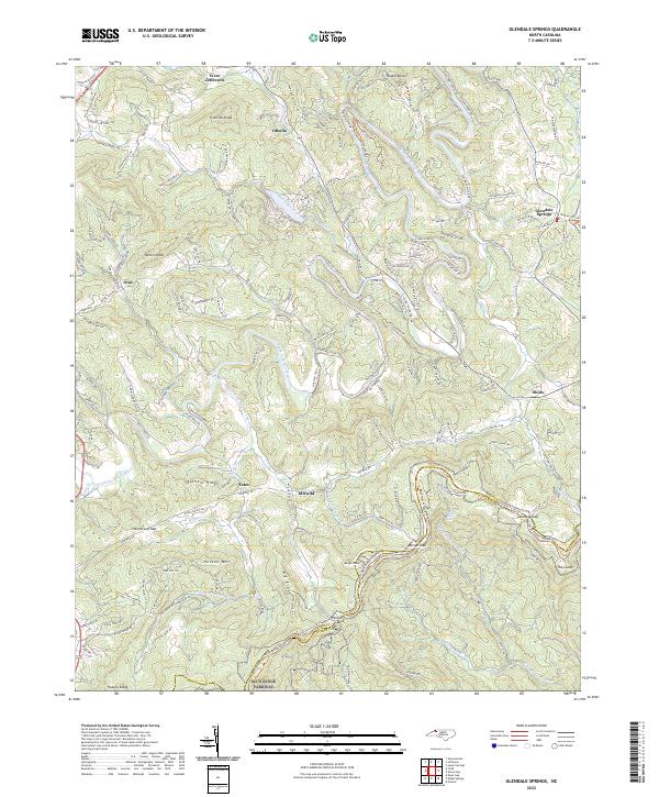
2022 Map of Glendale Springs
USGS Topo · Published 2022About this map
Glendale Springs and the surrounding high-country communities of Ashe County are defined by the winding course of the South Fork New River and the high elevations of the Blue Ridge. This modern survey illustrates the proximity of historical mountain settlements like Othello, Idlewild, and Obids to the protected corridor of the Blue Ridge Parkway. The terrain is characterized by prominent peaks and ridges including Frenches Knob, Henson Mtn, and Nettle Knob, which dictate the local road patterns and land use. The presence of numerous gaps, such as Benge Gap and Calloway Gap, highlights the importance of these natural passes for regional movement through the Appalachians. To the northwest, the edge of West Jefferson signals the transition toward more concentrated township development, while the rest of the sheet remains largely dominated by a network of creeks like South Beaver Creek and Wolfpen Cr.
Find a feature on this map
34 named features on this map. Tap any name to fly to it.
Don’t see what you’re looking for? This feature index may not catch every label — zoom into the map to look around manually.
Map Details
Editions of this 2022 Glendale Springs Map
This is the sole edition of this map. No revisions or reprints were ever made.
Other maps of this area

1889 · Wilkesboro
USGS Topo · 1:125,000

1891 · Wilkesboro
USGS Topo · 1:125,000

1893 · Cranberry
USGS Topo · 1:125,000

1895 · Cranberry
USGS Topo · 1:125,000

1899 · Cranberry
USGS Topo · 1:125,000

1902 · Cranberry
USGS Topo · 1:125,000

1936 · Blowing Rock
USGS Topo · 1:48,000

1942 · Blowing Rock
USGS Topo · 1:62,500

1953 · Winston-Salem
USGS Topo · 1:250,000

1955 · Winston-Salem
USGS Topo · 1:250,000