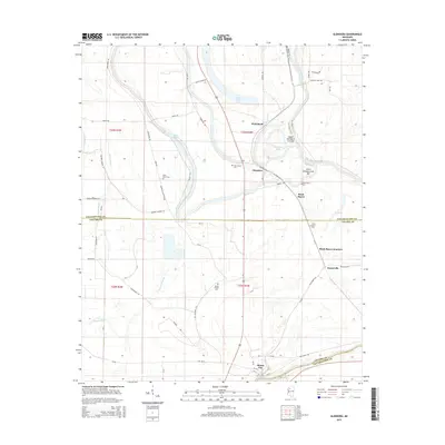
2015 Map of Glendora
USGS Topo · Published 2015About this map
The Tallahatchie River meanders through this portion of the Mississippi Delta, defining the landscape between Glendora and Minter City. This 2015 survey reveals a terrain deeply influenced by water management and agriculture, where the Upper Glendora Cut-Off and Lower Glendora Cut-Off illustrate efforts to channel the river's flow. The map is a valuable resource for genealogists, documenting several community landmarks such as Saint Marys Cem, Saint Peter Cem, and Jacobs Chapel Cem. A network of rural roads, including Equen Plantation Rd and Buford Landing St, connects the scattered settlements of Whitehead and Somerville. The presence of Black Bayou Junction and numerous bayous, such as Dugan Bayou and Parks Bayou, underscores the wetland nature of the boundary between Tallahatchie Co and Leflore Co.
Find a feature on this map
66 named features on this map. Tap any name to fly to it.
Don’t see what you’re looking for? This feature index may not catch every label — zoom into the map to look around manually.
Map Details
Editions of this 2015 Glendora Map
This is the sole edition of this map. No revisions or reprints were ever made.
Other maps of this area

1931 · Schlater
USGS Topo · 1:48,000

1931 · Sumner
USGS Topo · 1:48,000

1932 · Philipp
USGS Topo · 1:48,000

1934 · Schlater
USGS Topo · 1:62,500

1935 · Sumner
USGS Topo · 1:62,500

1935 · Philipp
USGS Topo · 1:62,500

1936 · Greenwood
USGS Topo · 1:62,500

1939 · Schlater
USGS Topo · 1:62,500

1939 · Sumner
USGS Topo · 1:62,500

1939 · Philipp
USGS Topo · 1:62,500