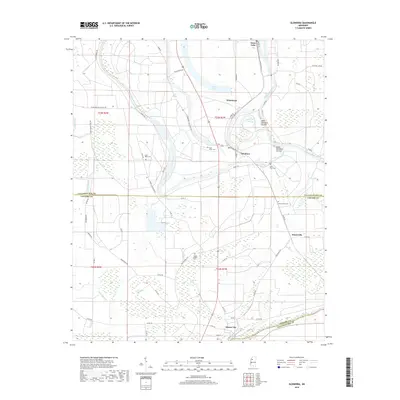
2018 Map of Glendora
USGS Topo · Published 2018About this map
The Tallahatchie River meanders through this portion of the Mississippi Delta, defining a landscape shaped by historical plantation boundaries and agricultural drainage. In the northern reaches, the community of Glendora sits near the river's edge, characterized by a series of distinct cut-offs like the Upper Glendora Cut-Off and Lower Glendora Cut-Off, which reveal the shifting nature of the river's course over time. The map is particularly rich in genealogical data, preserving the locations of numerous burial sites such as Saint Peter Cem, Saint Marys Cem, and Jones Grove Cem scattered across the alluvial plains.
Find a feature on this map
66 named features on this map. Tap any name to fly to it.
Don’t see what you’re looking for? This feature index may not catch every label — zoom into the map to look around manually.
Map Details
Editions of this 2018 Glendora Map
This is the sole edition of this map. No revisions or reprints were ever made.
Other maps of this area

1931 · Schlater
USGS Topo · 1:48,000

1931 · Sumner
USGS Topo · 1:48,000

1932 · Philipp
USGS Topo · 1:48,000

1934 · Schlater
USGS Topo · 1:62,500

1935 · Sumner
USGS Topo · 1:62,500

1935 · Philipp
USGS Topo · 1:62,500

1936 · Greenwood
USGS Topo · 1:62,500

1939 · Schlater
USGS Topo · 1:62,500

1939 · Sumner
USGS Topo · 1:62,500

1939 · Philipp
USGS Topo · 1:62,500