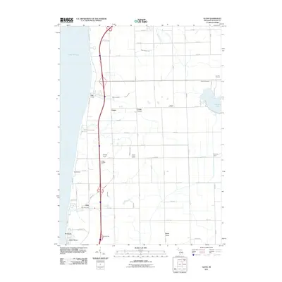
2011 Map of Glenn
USGS Topo · Published 2011About this map
The eastern shore of Lake Michigan anchors this Allegan County landscape, where small lakeside communities like Glenn and Pier Cove sit along the bluff. The 2011 survey reveals a transition from the water's edge to the agricultural interior of Ganges and Grange Corners. Genealogy researchers can locate several burial grounds, including the Taylor Cemetery, Loomis Cemetery, and the Plummerville Cemetery near Plummerville Creek. Aviation history is represented by the Reading Airport and the Stickel Landing Strip, while the eastern portion of the quadrangle is dominated by the recreational waters of Hutchins Lake. The area's infrastructure is defined by a grid of numbered avenues and the north-south corridor of Lakeshore Dr, supporting a mix of seasonal residential pockets like Beverly Beach and established rural sites such as Campit Camp Ground.
Find a feature on this map
47 named features on this map. Tap any name to fly to it.
Don’t see what you’re looking for? This feature index may not catch every label — zoom into the map to look around manually.
Map Details
Editions of this 2011 Glenn Map
This is the sole edition of this map. No revisions or reprints were ever made.
Other maps of this area

1927 · Bangor
USGS Topo · 1:62,500

1927 · South Haven
USGS Topo · 1:62,500

1928 · Fennville
USGS Topo · 1:62,500

1930 · South Haven
USGS Topo · 1:62,500

1931 · Fennville
USGS Topo · 1:62,500

1931 · Bangor
USGS Topo · 1:62,500

1943 · South Haven
USGS Topo · 1:62,500

1943 · Bangor
USGS Topo · 1:62,500

1958 · Racine
USGS Topo · 1:250,000

1962 · Racine
USGS Topo · 1:250,000