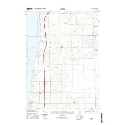
2017 Map of Glenn
USGS Topo · Published 2017About this map
Lake Michigan forms the western boundary of this coastal Allegan County landscape, where the primary arterial Blue Star Hwy facilitates travel between established settlements like Ganges and Glenn. The interior reflects a grid of local roads and family-named landmarks that trace the region's agricultural and social history. Several burial grounds, including Hutchins Cem and Plummerville Cem, are preserved near the shoreline and surrounding the community of Grange Corners. Water features such as Hutchins Lake and the wetlands of Mud Lake Swamp illustrate the diverse hydrology of the Lake Michigan shelf. Smaller hamlets like Pier Cove and Shorecrest dot the bluff line, while the southern reaches near Spring Grove are drained by Ockford Drain, showing the deliberate management of the land for residential and farming use during the early 21st century.
Find a feature on this map
46 named features on this map. Tap any name to fly to it.
Don’t see what you’re looking for? This feature index may not catch every label — zoom into the map to look around manually.
Map Details
Editions of this 2017 Glenn Map
This is the sole edition of this map. No revisions or reprints were ever made.
Other maps of this area

1927 · Bangor
USGS Topo · 1:62,500

1927 · South Haven
USGS Topo · 1:62,500

1928 · Fennville
USGS Topo · 1:62,500

1930 · South Haven
USGS Topo · 1:62,500

1931 · Fennville
USGS Topo · 1:62,500

1931 · Bangor
USGS Topo · 1:62,500

1943 · South Haven
USGS Topo · 1:62,500

1943 · Bangor
USGS Topo · 1:62,500

1958 · Racine
USGS Topo · 1:250,000

1962 · Racine
USGS Topo · 1:250,000