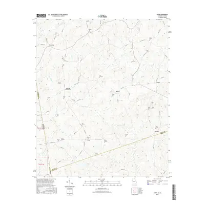
2017 Map of Glenn
USGS Topo · Published 2017About this map
O'Neals Crossroad and Denver serve as local landmarks in this rural landscape straddling the Alabama and Georgia border. The area is defined by a high concentration of small family and community burial grounds, such as State Line Cem, Garrett Cem, and the uniquely named Glenn-Burpee-Cole Cem, reflecting generations of local residency. A network of country roads connects these quiet settlements, where Panacea Airport provides a small aviation footprint amidst the winding courses of Whitewater Cr and Brush Cr.
Find a feature on this map
86 named features on this map. Tap any name to fly to it.
Don’t see what you’re looking for? This feature index may not catch every label — zoom into the map to look around manually.
Map Details
Editions of this 2017 Glenn Map
This is the sole edition of this map. No revisions or reprints were ever made.
Other maps of this area

1899 · Wedowee
USGS Topo · 1:125,000

1902 · Wedowee
USGS Topo · 1:125,000

1953 · Atlanta
USGS Topo · 1:250,000

1957 · Atlanta
USGS Topo · 1:250,000

1958 · Atlanta
USGS Topo · 1:250,000
1964 · Abbottsford
USGS Topo · 1:24,000
1964 · La Grange
USGS Topo · 1:24,000

1964 · Glenn
USGS Topo · 1:24,000

1964 · Hillcrest
USGS Topo · 1:24,000
1964 · Franklin
USGS Topo · 1:24,000