
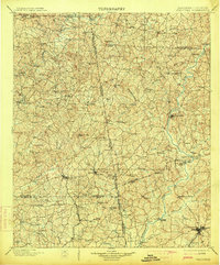
1902 Map of Wedowee
USGS Topo · Published 1902About this map
Wedowee serves as the central hub of this Alabama-Georgia borderland, a region defined by the winding courses of the Chattahoochee River and Tallapoosa River before the era of modern damming. The map reveals a landscape of dispersed agricultural settlements and early industry, including a Copper Mine near the northern boundary and localized milling sites. Navigation across the deep river valleys relied on points like Philpots Ferry, which provided a critical link between the rural communities of eastern Alabama and western Georgia. The survey documents the difficult terrain around Blackjack Mt. and the prominent landmark at Standing Rock, while the southern reaches show the emerging influence of the Atlanta & West Point R. R. near the growing hub of LaGrange. For genealogists, the map preserves the exact locations of vanished post offices and small hamlets like Centralhatchee, Eden Grove, and High Shoals.
Find a feature on this map
81 named features on this map. Tap any name to fly to it.
Don’t see what you’re looking for? This feature index may not catch every label — zoom into the map to look around manually.
Map Details
Editions of this 1902 Wedowee Map
3 editions found
Other maps of this area

1889 · Tallapoosa
USGS Topo · 1:125,000

1891 · Marietta
USGS Topo · 1:125,000

1891 · Ashland
USGS Topo · 1:125,000

1892 · Tallapoosa
USGS Topo · 1:125,000

1895 · Marietta
USGS Topo · 1:125,000

1897 · Marietta
USGS Topo · 1:125,000

1897 · Tallapoosa
USGS Topo · 1:125,000

1899 · Wedowee
USGS Topo · 1:125,000

1900 · Anniston
USGS Topo · 1:125,000

1901 · Marietta
USGS Topo · 1:125,000