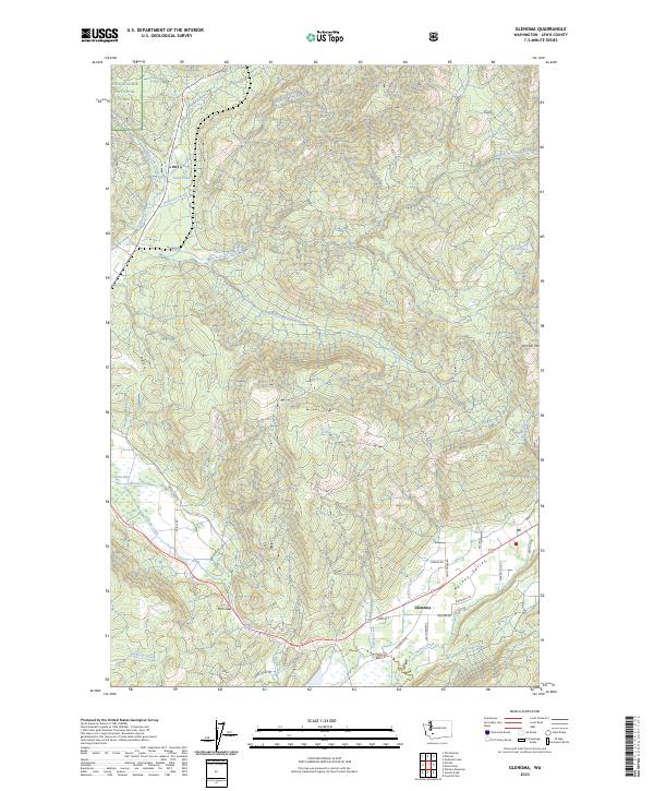
2023 Map of Glenoma
USGS Topo · Published 2023About this map
Glenoma occupies the lower reaches of Rainey Valley in this modern topographic record of Lewis County. The settlement is centered at the junction of local routes like Waterloo Rd and Glenoma Rd, where the flat floor of the valley transitions into the steep, timbered slopes of the Snoqualmie National Forest. The geography is defined by a dense network of drainages feeding into the Tilton River, including the West Fork and East Fork. High points like Johnson Mtn overlook the complex system of creeks such as Steffen Creek and Rainey Creek. This map reveals the contemporary road system including Kosmos Rd W and Davis Lake Rd, which serve small water bodies like Davis Lake and Ladd Pond. The map illustrates the persistent pattern of settlement along the valley floor, bounded by federal forest lands and divided by prominent terrain features like Fern Gap.
Find a feature on this map
40 named features on this map. Tap any name to fly to it.
Don’t see what you’re looking for? This feature index may not catch every label — zoom into the map to look around manually.
Map Details
Editions of this 2023 Glenoma Map
This is the sole edition of this map. No revisions or reprints were ever made.
Other maps of this area

1919 · Mount St Helens
USGS Topo · 1:125,000

1937 · Eatonville
USGS Topo · 1:125,000

1953 · Hoquiam
USGS Topo · 1:250,000

1953 · Elk Rock
USGS Topo · 1:62,500

1956 · Mineral
USGS Topo · 1:62,500

1957 · Hoquiam
USGS Topo · 1:250,000

1957 · Morton
USGS Topo · 1:62,500

1957 · Spirit Lake
USGS Topo · 1:62,500

1958 · Hoquiam
USGS Topo · 1:250,000

1962 · Hoquiam
USGS Topo · 1:250,000