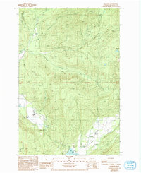
1987 Map of Glenoma
USGS Topo · Published 1993About this map
Rainy Valley provides a productive corridor for the settlement of Glenoma as it appeared in the late 1980s, bordered by the steep timberlands of the Snoqualmie National Forest. The landscape is defined by the complex drainage system of the West Fork, East Fork, and South Fork Tilton River, which converge through narrow passages like Coal Canyon. The map records an era of active land management, evidenced by numerous Borrow Pits and a Quarry scattered among private tracts and forest service land. At the southern edge, the rising waters of Riffe Lake and Rainy Creek meet the community at the Glenoma Community Park, while higher elevations feature isolated landmarks such as Ladd Pond and McKinley Lake. Geographers will note the transition from the industrial utility of the Sanitary Transfer Station to the natural bottleneck at Fern Gap.
Find a feature on this map
28 named features on this map. Tap any name to fly to it.
Don’t see what you’re looking for? This feature index may not catch every label — zoom into the map to look around manually.
Map Details
Editions of this 1987 Glenoma Map
2 editions found
Other maps of this area

1919 · Mount St Helens
USGS Topo · 1:125,000

1937 · Eatonville
USGS Topo · 1:125,000

1953 · Hoquiam
USGS Topo · 1:250,000

1953 · Elk Rock
USGS Topo · 1:62,500

1956 · Mineral
USGS Topo · 1:62,500

1957 · Hoquiam
USGS Topo · 1:250,000

1957 · Morton
USGS Topo · 1:62,500

1957 · Spirit Lake
USGS Topo · 1:62,500

1958 · Hoquiam
USGS Topo · 1:250,000

1962 · Hoquiam
USGS Topo · 1:250,000