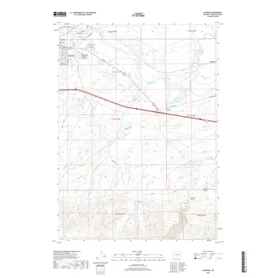
2018 Map of Glenrock
USGS Topo · Published 2018About this map
Glenrock sits along the southern banks of the North Platte River, serving as a central hub for the surrounding Converse County ranching and energy landscape. The map details the transition from the river valley to the complex drainages of the Laramie Mountains foothills, where numerous seasonal creeks like Hunton Cr and Battis Cr carve through the terrain. A notable historic corridor follows the river, marked by the Oregon Trl and the Fort Laramie St extension, reflecting the deep heritage of westward migration. Local landmarks such as the H A Unthank Grave and Glenrock Cem provide specific points of interest for genealogists and historians. To the south, the topography grows more intricate as it rises into Box Elder Canyon and Brighton Canyon, while the small settlement of Clayton occupies the eastern edge of the survey near Sand Creek.
Find a feature on this map
49 named features on this map. Tap any name to fly to it.
Don’t see what you’re looking for? This feature index may not catch every label — zoom into the map to look around manually.
Map Details
Editions of this 2018 Glenrock Map
This is the sole edition of this map. No revisions or reprints were ever made.
Other maps of this area

1949 · Careyhurst
USGS Topo · 1:24,000

1949 · Parkerton
USGS Topo · 1:24,000

1949 · Glenrock
USGS Topo · 1:24,000

1949 · Leuenberger Ranch
USGS Topo · 1:24,000

1949 · Glenrock NW
USGS Topo · 1:24,000

1949 · Hylton Ranch
USGS Topo · 1:24,000

1950 · Careyhurst
USGS Topo · 1:24,000

1950 · Leuenberger Ranch
USGS Topo · 1:24,000

1950 · Parkerton
USGS Topo · 1:24,000

1950 · Glenrock NW
USGS Topo · 1:24,000