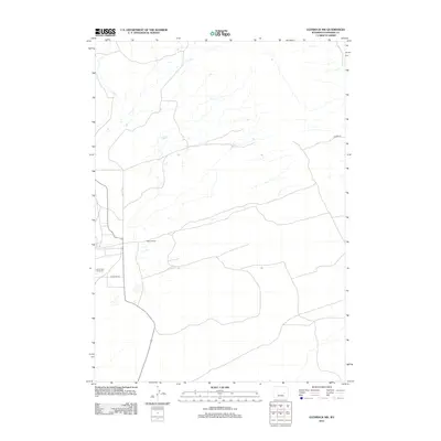
2012 Map of Glenrock NW
USGS Topo · Published 2012About this map
Hyland Ranch serves as a primary human landmark in this section of Converse County, marking the established ranching presence in the region during the early twenty-first century. The landscape is defined by the ephemeral watercourses and drainage patterns typical of the Wyoming basin, where road networks like Stoner Rd and Moncref Rd provide essential access between isolated holdings. In the southwest corner, the South Cole Creek Unit indicates a specific land management or energy production area, characteristic of the mixed-use terrain that balances agricultural operations with resource development. This 2012 survey illustrates the sparse but structured layout of the territory, where large-scale property divisions and local routes are the defining features of the rural geography.
Find a feature on this map
4 named features on this map. Tap any name to fly to it.
Don’t see what you’re looking for? This feature index may not catch every label — zoom into the map to look around manually.
Map Details
Editions of this 2012 Glenrock NW Map
This is the sole edition of this map. No revisions or reprints were ever made.
Other maps of this area

1949 · Campbell Hill
USGS Topo · 1:24,000

1949 · Parkerton
USGS Topo · 1:24,000

1949 · Glenrock
USGS Topo · 1:24,000

1949 · Glenrock NW
USGS Topo · 1:24,000

1949 · Hylton Ranch
USGS Topo · 1:24,000

1950 · Campbell Hill
USGS Topo · 1:24,000

1950 · Lockett
USGS Topo · 1:24,000

1950 · Parkerton
USGS Topo · 1:24,000

1950 · Glenrock NW
USGS Topo · 1:24,000

1950 · Glenrock
USGS Topo · 1:24,000