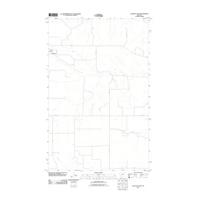
2011 Map of Glentana East
USGS Topo · Published 2011About this map
Glentana occupies the northwestern corner of this High Line landscape, where the Glentana Post Office serves as the primary landmark for this rural Valley County community. The settlement pattern is defined by a strictly rectilinear grid of section roads and farm-to-market routes, including Rte 248 and Fas 438, which facilitate the movement of agricultural goods across the northern plains. In the southern reaches of the quadrangle, the drainage of Hell Creek provides a break in the geometric road network, winding through the open country. Local history is etched into the landscape through family-named thoroughfares such as Zemliska Rd, Dighans Rd, and Stahl Rd, reflecting the homesteading families that established the region's agricultural footprint.
Find a feature on this map
12 named features on this map. Tap any name to fly to it.
Don’t see what you’re looking for? This feature index may not catch every label — zoom into the map to look around manually.
Map Details
Editions of this 2011 Glentana East Map
This is the sole edition of this map. No revisions or reprints were ever made.
Other maps of this area

1954 · Glasgow
USGS Topo · 1:250,000

1957 · Glasgow
USGS Topo · 1:250,000

1958 · Glasgow
USGS Topo · 1:250,000

1973 · Glentana West
USGS Topo · 1:24,000

1973 · Larslan NW
USGS Topo · 1:24,000

1973 · Baylor NE
USGS Topo · 1:24,000

1973 · Brockway Spring
USGS Topo · 1:24,000

1973 · Johnnys Hill
USGS Topo · 1:24,000

1973 · Richland
USGS Topo · 1:24,000

1973 · Kaminski Hill
USGS Topo · 1:24,000