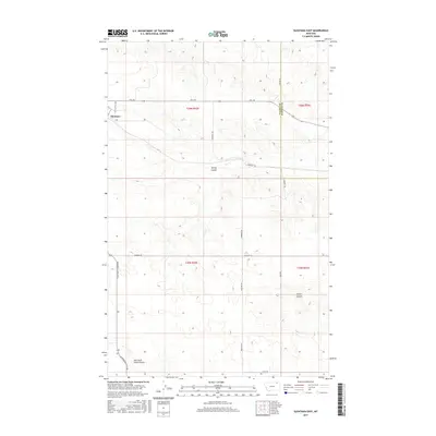
2017 Map of Glentana East
USGS Topo · Published 2017About this map
Glentana anchors this northern Montana landscape where the high plains transition between Valley and Daniels counties. This 2017 survey details a region defined by its vast agricultural sections and the drainage patterns of seasonal coulees that carve through the prairie. The map provides a precise look at the township and range system across t36n r42e and adjacent blocks, illustrating the grid of section lines and rural connectors like Little Bailey Rd and Glentana-Nashua Rd.
Find a feature on this map
20 named features on this map. Tap any name to fly to it.
Don’t see what you’re looking for? This feature index may not catch every label — zoom into the map to look around manually.
Map Details
Editions of this 2017 Glentana East Map
This is the sole edition of this map. No revisions or reprints were ever made.
Other maps of this area

1954 · Glasgow
USGS Topo · 1:250,000

1957 · Glasgow
USGS Topo · 1:250,000

1958 · Glasgow
USGS Topo · 1:250,000

1973 · Glentana West
USGS Topo · 1:24,000

1973 · Larslan NW
USGS Topo · 1:24,000

1973 · Baylor NE
USGS Topo · 1:24,000

1973 · Brockway Spring
USGS Topo · 1:24,000

1973 · Johnnys Hill
USGS Topo · 1:24,000

1973 · Richland
USGS Topo · 1:24,000

1973 · Kaminski Hill
USGS Topo · 1:24,000