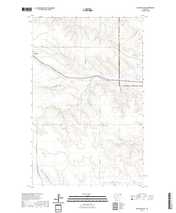
2024 Map of Glentana East
USGS Topo · Published 2024About this map
Glentana serves as the primary focal point of this northeastern Montana landscape, situated at the junction of Rte 248 and the Glentana-Nashua Rd. The area is defined by a series of drainage systems, most notably Spring Coulee and the East Fork Snow Coulee, which carve through the high plains. This map illustrates the intersection of local infrastructure and the natural topography, where section lines and county boundaries dictate the path of travel.
Find a feature on this map
20 named features on this map. Tap any name to fly to it.
Don’t see what you’re looking for? This feature index may not catch every label — zoom into the map to look around manually.
Map Details
Editions of this 2024 Glentana East Map
This is the sole edition of this map. No revisions or reprints were ever made.
Other maps of this area

1954 · Glasgow
USGS Topo · 1:250,000

1957 · Glasgow
USGS Topo · 1:250,000

1958 · Glasgow
USGS Topo · 1:250,000

1973 · Glentana West
USGS Topo · 1:24,000

1973 · Larslan NW
USGS Topo · 1:24,000

1973 · Baylor NE
USGS Topo · 1:24,000

1973 · Brockway Spring
USGS Topo · 1:24,000

1973 · Johnnys Hill
USGS Topo · 1:24,000

1973 · Richland
USGS Topo · 1:24,000

1973 · Kaminski Hill
USGS Topo · 1:24,000