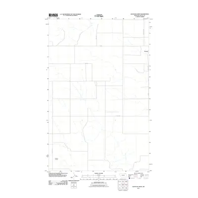
2011 Map of Glentana West
USGS Topo · Published 2011About this map
Glentana sits near the eastern edge of this northern Montana landscape, where the rectilinear grid of section lines and gravel roads dictates the movement of people and commerce. The terrain is defined by its agricultural utility, evidenced by the presence of the Redfield Ag Strip and a network of named rural routes such as Eliason Rd and Walstad Rd. These roads provide the primary infrastructure for this high-plains region, connecting isolated homesteads to the small community hub. Local transit is further served by Rte-248 and the arterial Nashua N Rd, while smaller tracks like Cemetery Rd point toward essential local landmarks. The map illustrates a contemporary view of the Big Sky Country's dryland farming patterns and the enduring importance of named family roads in Valley County.
Find a feature on this map
10 named features on this map. Tap any name to fly to it.
Don’t see what you’re looking for? This feature index may not catch every label — zoom into the map to look around manually.
Map Details
Editions of this 2011 Glentana West Map
This is the sole edition of this map. No revisions or reprints were ever made.
Other maps of this area

1954 · Glasgow
USGS Topo · 1:250,000

1957 · Glasgow
USGS Topo · 1:250,000

1958 · Glasgow
USGS Topo · 1:250,000

1973 · Glentana West
USGS Topo · 1:24,000

1973 · Larslan NW
USGS Topo · 1:24,000

1973 · Baylor NE
USGS Topo · 1:24,000

1973 · Baylor
USGS Topo · 1:24,000

1973 · Opheim
USGS Topo · 1:24,000

1973 · Roanwood
USGS Topo · 1:24,000

1973 · Kaminski Hill
USGS Topo · 1:24,000