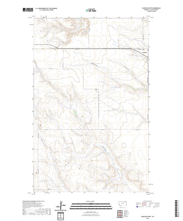
2024 Map of Glentana West
USGS Topo · Published 2024About this map
Glentana sits at the northeastern edge of this landscape, serving as a primary point of settlement in Valley County. The terrain is defined by the drainage patterns of Spring Coulee and Bog Coulee, which carve through the high plains of north-central Montana. This 2024 survey documents a network of rural routes that bear the names of local families and geographic landmarks, such as Eliason Rd, Keough Rd, and Heinze Rd. These naming conventions often reflect the legacy of early 20th-century homesteaders who established the agricultural character of the region. The map also identifies Glentana Cem and a grid of secondary roads like Rte 248, providing a clear look at how contemporary land use and historical property boundaries continue to shape this portion of the Montana prairie.
Find a feature on this map
18 named features on this map. Tap any name to fly to it.
Don’t see what you’re looking for? This feature index may not catch every label — zoom into the map to look around manually.
Map Details
Editions of this 2024 Glentana West Map
This is the sole edition of this map. No revisions or reprints were ever made.
Other maps of this area

1954 · Glasgow
USGS Topo · 1:250,000

1957 · Glasgow
USGS Topo · 1:250,000

1958 · Glasgow
USGS Topo · 1:250,000

1973 · Glentana West
USGS Topo · 1:24,000

1973 · Larslan NW
USGS Topo · 1:24,000

1973 · Baylor NE
USGS Topo · 1:24,000

1973 · Baylor
USGS Topo · 1:24,000

1973 · Opheim
USGS Topo · 1:24,000

1973 · Roanwood
USGS Topo · 1:24,000

1973 · Kaminski Hill
USGS Topo · 1:24,000