
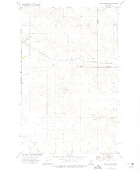
1973 Map of Glentana West
USGS Topo · Published 1976About this map
The small settlement of Glentana anchors the eastern edge of this 1970s landscape in Valley County, Montana. This high plains environment is defined by its drainage patterns, most notably the seasonal waterways of Bog Coulee and Snow Coulee that cut through the rolling terrain. The presence of several Spring points indicates the vital role of local hydrology in an area otherwise dominated by the open range and agricultural allotments typical of this region.
Find a feature on this map
5 named features on this map. Tap any name to fly to it.
Don’t see what you’re looking for? This feature index may not catch every label — zoom into the map to look around manually.
Map Details
Editions of this 1973 Glentana West Map
This is the sole edition of this map. No revisions or reprints were ever made.
Other maps of this area

1954 · Glasgow
USGS Topo · 1:250,000

1957 · Glasgow
USGS Topo · 1:250,000

1958 · Glasgow
USGS Topo · 1:250,000

1973 · Larslan NW
USGS Topo · 1:24,000

1973 · Baylor NE
USGS Topo · 1:24,000

1973 · Baylor
USGS Topo · 1:24,000

1973 · Opheim
USGS Topo · 1:24,000

1973 · Roanwood
USGS Topo · 1:24,000

1973 · Kaminski Hill
USGS Topo · 1:24,000
1973 · Glentana East
USGS Topo · 1:24,000