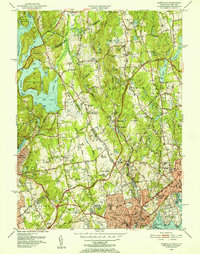
1951 Map of Glenville
USGS Topo · Published 1952About this map
Kensico Reservoir and the expansive Rye Lake dominate the western landscape of this borderland survey, where the rolling wooded hills of Fairfield Co meet Westchester Co. This era shows a transition from rural estates and orchards to modern infrastructure, highlighted by the sprawling County Airport and the path of the Merritt Parkway. Institutional footprints are significant across the terrain, featuring the Convent of the Sacred Heart, St Lukes Hospital, and the Mary Harkness Home.
Find a feature on this map
110 named features on this map. Tap any name to fly to it.
Don’t see what you’re looking for? This feature index may not catch every label — zoom into the map to look around manually.
Map Details
Editions of this 1951 Glenville Map
3 editions found
Other maps of this area

1891 · Harlem
USGS Topo · 1:62,500

1892 · Stamford
USGS Topo · 1:62,500

1892 · Tarrytown
USGS Topo · 1:62,500

1893 · Stamford
USGS Topo · 1:62,500

1893 · Tarrytown
USGS Topo · 1:62,500

1897 · Harlem
USGS Topo · 1:62,500

1897 · Oyster Bay
USGS Topo · 1:62,500

1898 · Harlem
USGS Topo · 1:62,500

1898 · Oyster Bay
USGS Topo · 1:62,500

1899 · Stamford
USGS Topo · 1:62,500