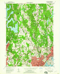
1951 Map of Glenville
USGS Topo · Published 1960About this map
Westchester County Airport dominates the central landscape of this border region in the early 1950s, surrounded by the suburban estates and institutional grounds that define the area. The map illustrates a high concentration of private clubs and educational institutions, such as Rosemary Hall and the Convent of the Sacred Heart, highlighting the mid-century transition from rural farmland to prestigious residential enclaves. To the west, the massive Kensico Reservoir and its associated Bear Gutter Inlet stand as critical infrastructure for the growing metropolitan region.
Find a feature on this map
91 named features on this map. Tap any name to fly to it.
Don’t see what you’re looking for? This feature index may not catch every label — zoom into the map to look around manually.
Map Details
Editions of this 1951 Glenville Map
3 editions found
Other maps of this area

1891 · Harlem
USGS Topo · 1:62,500

1892 · Stamford
USGS Topo · 1:62,500

1892 · Tarrytown
USGS Topo · 1:62,500

1893 · Stamford
USGS Topo · 1:62,500

1893 · Tarrytown
USGS Topo · 1:62,500

1897 · Harlem
USGS Topo · 1:62,500

1897 · Oyster Bay
USGS Topo · 1:62,500

1898 · Harlem
USGS Topo · 1:62,500

1898 · Oyster Bay
USGS Topo · 1:62,500

1899 · Stamford
USGS Topo · 1:62,500