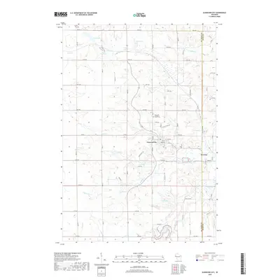
2018 Map of Glenwood City
USGS Topo · Published 2018About this map
Glenwood City and the neighboring community of Downing serve as the primary hubs in this western Wisconsin landscape along the border of Saint Croix and Dunn Counties. The terrain is defined by a dense network of waterways, including the winding Tiffany Cr and its southern branch, S Tiffany Cr, which carve through the rural countryside. Local history is anchored at sites like the Saint John the Baptist Catholic Cem, providing a point of reference for genealogists tracing families in the area.
Find a feature on this map
49 named features on this map. Tap any name to fly to it.
Don’t see what you’re looking for? This feature index may not catch every label — zoom into the map to look around manually.
Map Details
Editions of this 2018 Glenwood City Map
This is the sole edition of this map. No revisions or reprints were ever made.
Other maps of this area

1946 · Knapp
USGS Topo · 1:62,500

1948 · Downing
USGS Topo · 1:62,500

1949 · Knapp
USGS Topo · 1:62,500

1949 · Baldwin
USGS Topo · 1:62,500

1950 · Downing
USGS Topo · 1:62,500

1950 · Deer Park
USGS Topo · 1:62,500

1953 · Saint Paul
USGS Topo · 1:250,000

1953 · Stillwater
USGS Topo · 1:250,000

1955 · Stillwater
USGS Topo · 1:250,000

1958 · Stillwater
USGS Topo · 1:250,000