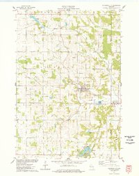
1975 Map of Glenwood City
USGS Topo · Published 1978About this map
Glenwood City serves as the central hub of this 1970s landscape, situated at the confluence of several key transportation corridors. The Soo Line tracks cut through the terrain, while the remnants of an Old Railroad Grade and Old RR Grade trace the legacy of earlier logistical networks. The town itself is well-defined, featuring the Fairground, High Sch, and a local Cem. Outside the city limits, the rural character is punctuated by numerous Gravel Pits, indicating active local extraction industries.
Find a feature on this map
34 named features on this map. Tap any name to fly to it.
Don’t see what you’re looking for? This feature index may not catch every label — zoom into the map to look around manually.
Map Details
Editions of this 1975 Glenwood City Map
This is the sole edition of this map. No revisions or reprints were ever made.
Other maps of this area

1946 · Knapp
USGS Topo · 1:62,500

1948 · Downing
USGS Topo · 1:62,500

1949 · Knapp
USGS Topo · 1:62,500

1949 · Baldwin
USGS Topo · 1:62,500

1950 · Downing
USGS Topo · 1:62,500

1950 · Deer Park
USGS Topo · 1:62,500

1953 · Saint Paul
USGS Topo · 1:250,000

1953 · Stillwater
USGS Topo · 1:250,000

1955 · Stillwater
USGS Topo · 1:250,000

1958 · Stillwater
USGS Topo · 1:250,000