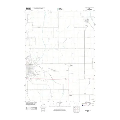
2010 Map of Glenwood
USGS Topo · Published 2010About this map
Glenwood serves as the primary hub in this southwestern Iowa landscape, defined by its traditional grid and community infrastructure including the Glenwood Post Office and the Glenwood Recreation Complex. To the northeast, the smaller settlement of Silver City sits near the banks of Silver Creek, anchored by the Silver City Post Office. The quadrangle reflects a deeply rooted agrarian history, evidenced by a high density of burial sites across the township. Genealogists may find particular value in the diverse types of resting places documented here, ranging from the Somar Family on Wright Farm Cemetery to the County Farm Cemetery and the State Cemetery. The terrain is drained by several waterways, most notably Keg Creek and Waubonsie Creek, which cut through a network of rural roads such as Dobney Ave and Hershey Ave.
Find a feature on this map
33 named features on this map. Tap any name to fly to it.
Don’t see what you’re looking for? This feature index may not catch every label — zoom into the map to look around manually.
Map Details
Editions of this 2010 Glenwood Map
This is the sole edition of this map. No revisions or reprints were ever made.
Other maps of this area

1935 · Nehawka
USGS Topo · 1:48,000

1940 · Nehawka
USGS Topo · 1:62,500

1954 · Omaha
USGS Topo · 1:250,000

1955 · Nebraska City
USGS Topo · 1:250,000

1956 · Glenwood
USGS Topo · 1:24,000

1956 · Mineola
USGS Topo · 1:24,000

1956 · Rock Bluff
USGS Topo · 1:24,000

1956 · Pacific Junction
USGS Topo · 1:24,000

1956 · Treynor
USGS Topo · 1:24,000

1956 · Council Bluffs South
USGS Topo · 1:24,000